

At-a-glance overview
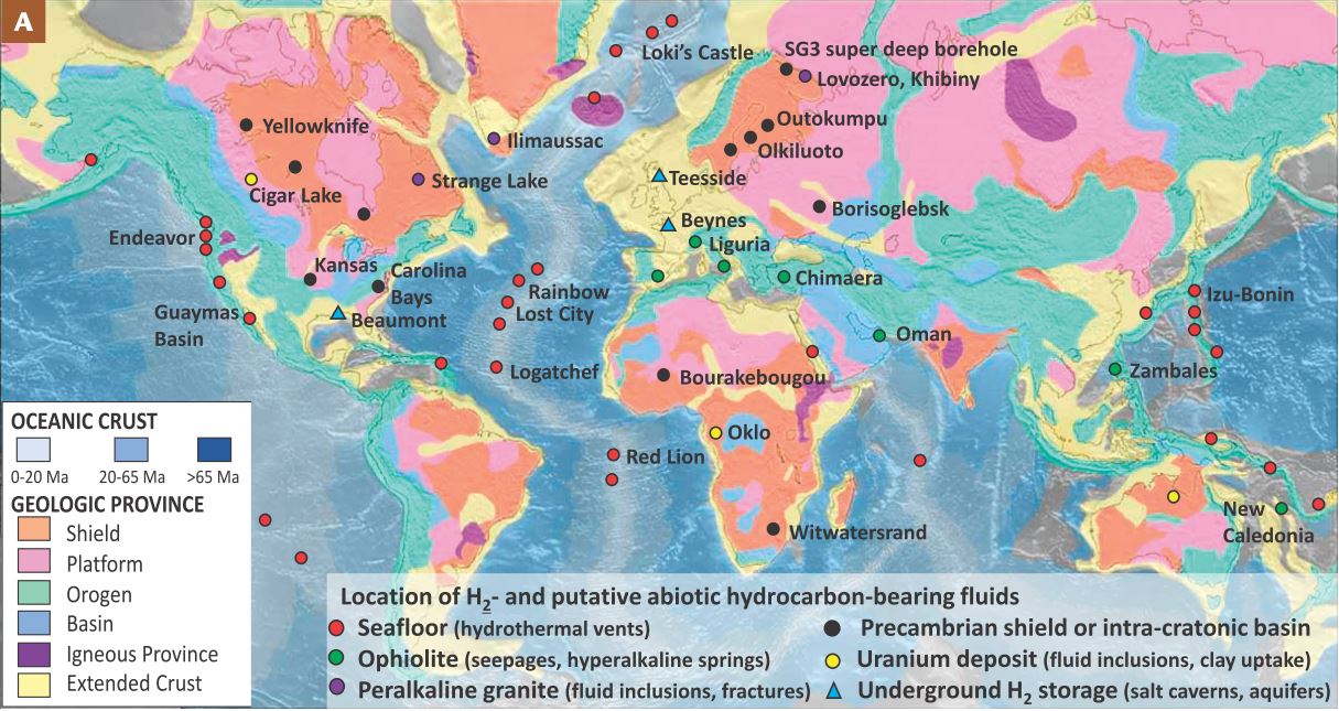
World geological map showing the location of some well-documented occurrences of fluids enriched in H2 and putative abiotic hydrocarbons in the Earth’s crust. The color code of the symbols is a first-order classification based on the geological context. Sources of H2 in intracratonic basins are currently poorly constrained. Also shown are locations where large quantities of gaseous H2, mostly produced by steam reforming of natural gas, have been stored in salts caverns such as Beaumont (Texas, USA) and Teesside (UK) and in aquifers such as at Beynes (France). Map courtesy of the US GeoloGical survey, (Truche and Bazarkina, 2019).

Updated on 18 May 2021
